Precision Ag Tech for Advisors: Taranis Insights

Taranis Crop Intelligence for Advisors

Unlocking growth opportunities. Creating prosperity.

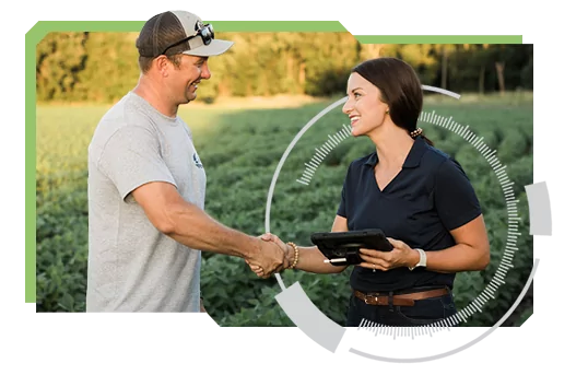
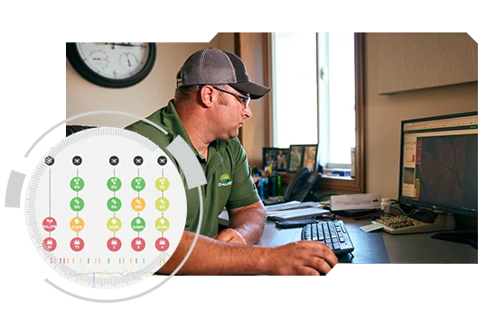
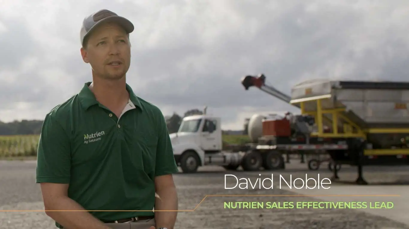
Deliver the service your growers deserve.

You do great work—show it off.

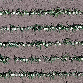
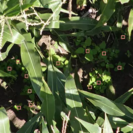
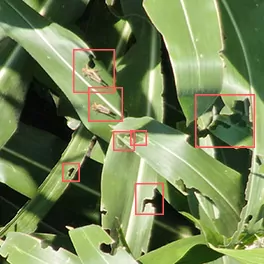
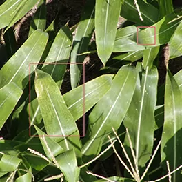
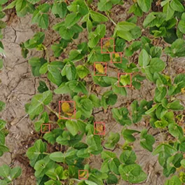
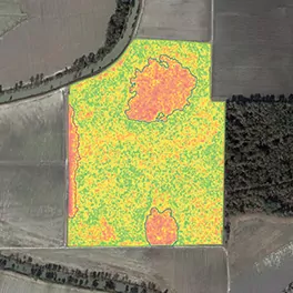
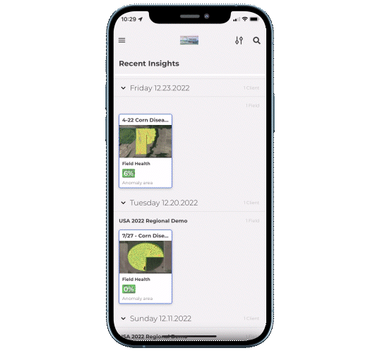
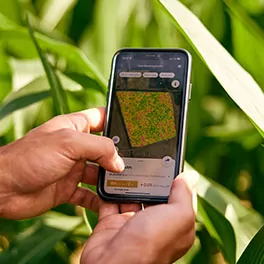
Taranis allows you to know, respond, and engage your growers. You have too many acres to cover. Don’t spend your time collecting data. Spend your time making a difference for your growers.

CHOOSE YOUR PLAN

Leaf-level insights

Get ground truth precision on every acre in every field, based on submillimeter image resolution and AI technology. Eliminate guesswork and create quality action plans that your growers trust.

Nothing is better than a good start

Stand Count

Prioritize your fields and invest properly throughout the season.

Control your fields

Weed Detection

By the acre, know your weed pressure and severity and take action.

Show them the door

Insect Damage

Understand the threat and economic thresholds, so you can take action.

Identify specific threats

Disease Pressure

Know the diseases that could be threatening your crops.

Improve soil & crop health

Nutrient Deficiency

Know what is or isn't working and adjust your plans with confidence.

Keep fields healthy over time

Field Health Trends

See anomalies in the field and dive deeper.

SEE OUR CROP IMAGE GALLERY

All your fields in one place

Track your fields and visualize your most important areas of opportunity via a central dashboard. Easy access to data from current and previous seasons brings greater efficiency, helping advisors focus on growers and fields that require the most attention.

Year-round planning starts with great data

Previous season data helps you build an effective long-term field management plan and address threats before they take a toll. Track progress through the years so you can better plan for inputs, seed selection, management practices, and other interventions to improve crop performance.

Field insights at your fingertips

Access data and insights anytime from anywhere. Whether you are in the field or preparing for the next customer conversation, view your farms, track field health, and investigate alerts anytime with the Taranis mobile app.

How it Works

Acquisition

We scan your fields throughout the season and gather data at submillimeter resolution.

Analysis

Our system delivers actionable crop insights based on powerful AI and agronomy expertise.

Action

Visualize and prioritize the needs in your fields and engage growers for the right course of action.

LEARN MORE

Advisor Resources

July 17, 2024

Taranis Launches Ag Assistant™ to Transform Farm Decision Making

The agriculture industry’s first generative AI-powered agronomy engine transforms crop input and farm management decision making.

Read more

Steve Patterson’s Transformative Talk: The Power of Pause and Precision

Comparing the impact of Taranis to the advent of precision agriculture, which he helped introduce earlier in his career, Patterson offered, "I believe Taranis is the BIGGEST thing that's come along since precision agriculture. This is what agriculture's been waiting for. A view from the sky of what the problems are, so better decisions can be made."

Read more

Winning in Agriculture: Combining Experience with Data for Best Outcomes

Gain insights from Purdue's Dr. Scott Downey on data-driven sales strategies. "Experience without data is just someone’s opinion," he shares at the 2025 Taranis Sales Kickoff.

Read more

FREQUENTLY ASKED QUESTIONS

Can I brand the Taranis service for my customers?

Yes. Taranis offers ag retailers a custom-branded app and co-branded materials to let you provide your growers a complete service and enhanced experience under your brand.

What is the difference between Taranis and other crop intelligence services?

With Taranis, there’s no guesswork. You’re not left puzzled by blobs from satellite imagery. With a click of a button, you have clear, definitive leaf-level insights. Technology alone doesn’t guarantee success, but our team of agribusiness professionals will. We are with you every step of the way—in person, via webinar, on the phone—proactively.

What do I need to do to get this service?

First, choose a service plan. Our Customer Success Team will work with you to get field boundaries and planting dates. We take care of everything, so you have more time to engage your growers.

Why do you use both aerial imagery and satellite data?

Satellite data without leaf-level imagery has limited value. When you combine them together, you can understand what’s actually happening at a leaf-level—acre-by-acre throughout the season.

What resources are available to learn more about the Taranis service?

The Taranis Knowledge Center includes useful information to help you familiarize yourself with our services. Check it out to see training videos, discover the insights provided through our platform, review ‘How-to’ guides, and more.

Get the latest updates from Taranis