Short, to the point, and chock-full of the information you need to make the most out of every input this season, the Taranis Know2Grow webinar series is just what it says it is.
Entering her fourth planting season with Taranis, Director of Customer Success Katie Staton shares how the company and its team are bridging the gap between growers and retailers across the country by putting an apple-to-apples management discussion in the palm of their hand.
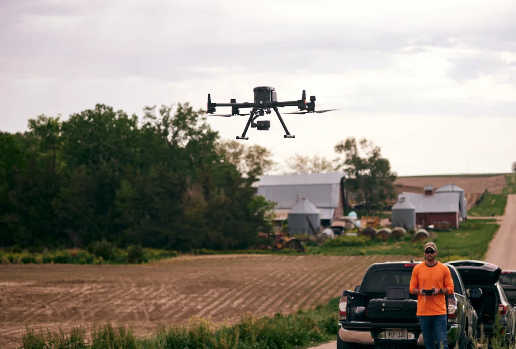
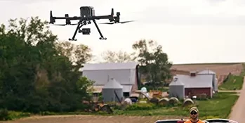
“We don’t ask you to buy the drone or fly the field—we do all of the work, all of the acquiring of data. All we need to get started is your field boundary and planting information,” Staton told attendees of the webinar.
Taranis uses AI and machine learning to deliver actionable insights and management opportunities that allow retailers to aid farmers in prioritizing the “Why, what and how to solve” formula. It’s how the company is truly moving every acre forward.
A Taranis flight cadence consists of six missions. The first flight is, arguably, the most critical of the season and establishes standability.
“We need your planting information within 48-hours because once that information is input, our software model will immediately begin counting GDUs,” Staton says. “We will fly early – we want to be flying at spike because the goal is to have all corn plants emerge uniformly within 12-24 hours.”
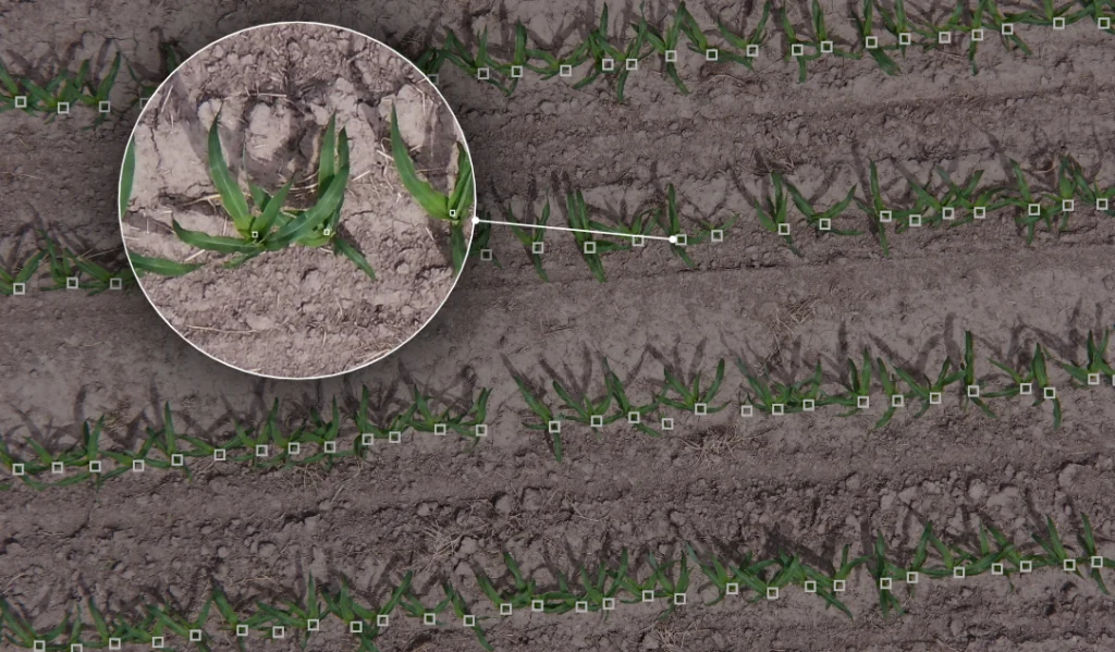
If 90% standability is achieved, verified by the first flight, the Taranis team will run threat assessments for the remaining five flights. If the stand count is less than 90%, the second flight will be flown no later than 10-days later to establish replant needs.
“We’ll come back and do a second stand count to verify how many plants are in the field and what we need to do for the rest of the season. Do we need to tailor a nutritional program, or do we have early weed breakthroughs,” she asks, adding that the first two flights provide both broadleaf and grass weed thresholds to help maintain proactive management opportunities throughout the season.
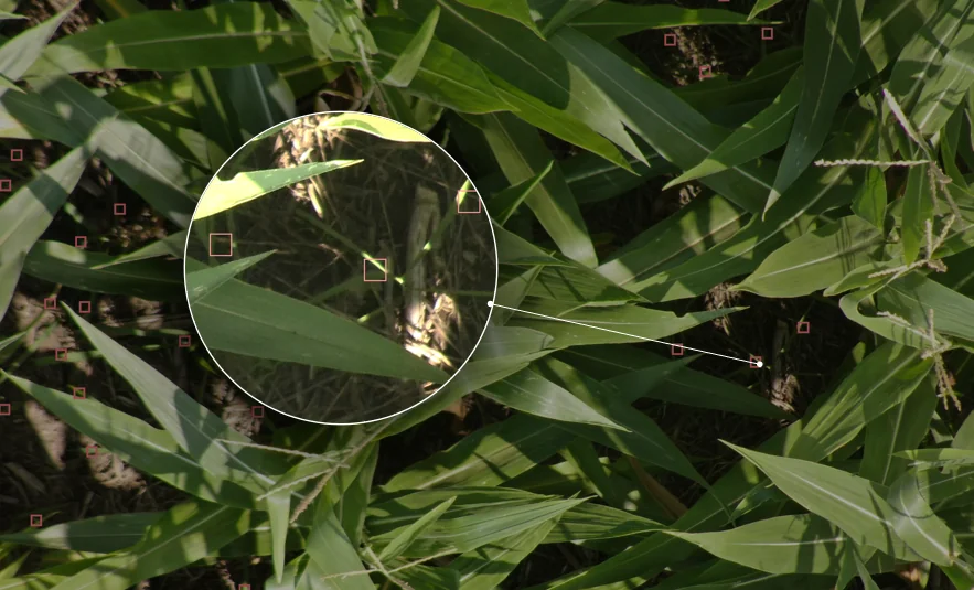
Taranis identifies weeds and insects by species and provides the high-resolution imagery retailers need to differentiate between nutrient deficiencies and in-season diseases accurately. Every acre is captured. One acre = one high-resolution image (sub-millimeter resolution so clear you can count the spots on a ladybug).
“We give you the information you need to put every input dollar to work,” Staton says. “We find so much value in giving you the information up front that allows for a proactive management response.”
Taranis sets up the ideal “show me” ground truthing scenario and takes the work out of identifying those areas that need a boots-on-the-ground look. Scouting with satellite imagery is difficult. Discerning the reds, greens, and blues on the page to make sense of what is happening requires time. A partnership between Taranis and Planet Labs takes ground truthing beyond a color-coded map to show the anomalies within a field. These complimentary images are taken at least once a day and delivered to your dashboard. Anomalies are calculated twice a week.
“What we do is point you to areas where you can leverage the Connect app to pinpoint your scouting needs. We can see all the way through the canopy, so if there is a weed there, the software will identify it,” she said. “There is no better opportunity to build trust in the retailer-farmer relationship than to uncover a weed hidden by the crop canopy!”
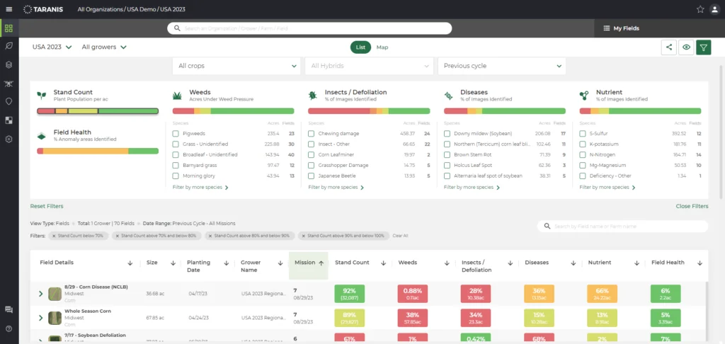
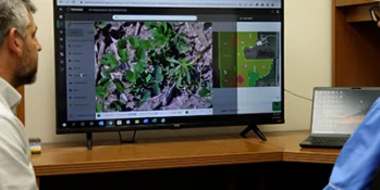
Staton showed attendees both the web and mobile applications that start her day, every day. Going a step further, she offered, “If I’m a retailer, this is the app I’m starting my day with, too, because it tells me where I’m going that day and why I’m going there. Once I get to the field, I’m using the Connect app while I’m physically walking the field and dropping pins and taking notes and photos to share with the decision makers I’m working with.”
The ability to fine-tune the output of the dashboard creates insight opportunities that may otherwise be overlooked. For instance, adding hybrid information along with the planting date on the dashboard allows you to evaluate performance year-over-year for a chance to visit with your seed provider.
In-season, the ability to sort on the dashboard lets you prioritize and create map layers, zones for prescriptions, and remote scouting—all features Staton will cover in future Know2Grow webinars.
Click here to review the rest of the insights and get a play-by-play of Staton’s demonstration in this Know2Grow webinar.
Starting a new lease off on the right foot is beneficial for both the landowner and farmer and can be achieved by aligning goals and establishing a transparent relationship built on honesty and trust.

This is the first blog in a series where we will discuss AI technology and how to apply it to Precision Agriculture methodologies and how, ultimately, AI can take your farm to a new level of efficiency and prosperity.
Because we are one of the nation's largest drone operators in agriculture, we often are asked, "Is it legal for drones to fly over my farm?"